Froonp
Posts: 7995
Joined: 10/21/2003
From: Marseilles, France
Status: offline

|
quote:
ORIGINAL: Gendarme
Just a question to whomever can answer:
I've been looking at screenshots from the map for Matrix Wif and noticed some differences from paper Wif regarding placement of ports.
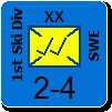
For example, on the old Wif Pacific map, Guadalcanal is a minor port on the Coral Sea sea zone, but in Matrix Wif, it looks to be a port on Solomons sea zone.
Also, both ports in the New Herbrides (Espiritu Santo and Port Vila) connect to multiple sea zones, Espiritu Santo connecting to Solomons and Coral sea zones, and Port Vila connecting to the above sea zones plus New Zealand coast. On the Matrix Wif map of the region, this doesn't appear to be so; Espiritu Santo only connects to Solomons, and Port Vila's port, I can't tell which sea zone it's supposed to be on because it lies in the middle of the island. Is this just a fluke of whatever program was used to create the map for Matrix Wif, and the computer will know those ports to be adjacent to the sea zones they are supposed to be per the paper Wif map?
Thanks.
Anthony DeChristopher
I think that the confusion comes from the fact that you seems to believe that the port symbol is important as to know to which sea area it connects.
It is not.
What is important is the hex that contains the port, and which sea areas that hex connects to.
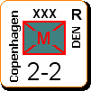
For example, Port Vila on the screen shot above connects to 3 Sea areas, because the hex it is in connects to 3 sea areas. Where the port symbol is within the hex don't matters.
If you have this confusion in WiF FE, you must be one of those people that believe that Batavia only connect to 1 Sea area, aren't you ? Well, it connects to 2 sea areas.
|
 Printable Version
 Ports on map -


 New Messages
 No New Messages
 Hot Topic w/ New Messages
 Hot Topic w/o New Messages
 Locked w/ New Messages
 Locked w/o New Messages
 Post New Thread