Shannon V. OKeets
Posts: 22095
Joined: 5/19/2005
From: Honolulu, Hawaii
Status: offline

|
quote:
ORIGINAL: c92nichj
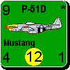
I wouldn't mind having nice graphics there (some tanks in frozen mud comes to mind), but I don't see a reason to have charts and other info that you need to reference on the map.
On a paper game sure there space is limited, but in a computergame I cannot really see why you would print charts on the map, they would be much better to get using the help menu.
It has to do with knowledge of how to acquire information and the requisite keystrokes/mouse clicks.
When you have a good undestanding of how the help menu provides information, and assuming it does so with a minimum of fuss and bother, that is the place to get charts et al. Actually, CWIF had a drop down list of "Information" which seems like a good idea to keep fpr MWIF.
However, when you are new to software, solving the problem of how to get help can be harder than the original problem you are trying to solve. Personally, I have a going in expectation that any help system will provide me with zero help, just 10 - 15 minutes of additional frustration, until I give up on it. Going to the help menu is a last resort.
So, having some commonly needed information placed on the map, positions it where even new players (first time looking at the game) are likely to come across it, and know where to look if they what to examine it in the future. It can also serve as a subtle attempt to get the players interested in the underlying tables and charts that drive movement and combat - get them to go read up on the rules.
_____________________________
Steve
Perfection is an elusive goal.
|
 Printable Version
 RE: Maps for MWIF -


 RE: Maps for MWIF -
  New Messages
 No New Messages
 Hot Topic w/ New Messages
 Hot Topic w/o New Messages
 Locked w/ New Messages
 Locked w/o New Messages
 Post New Thread