Shannon V. OKeets
Posts: 22095
Joined: 5/19/2005
From: Honolulu, Hawaii
Status: offline

|
quote:
ORIGINAL: Hairog
Silly me of course the St. Lawrence Seaway was not completed until 1959. Duh. 
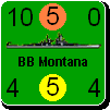
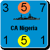
The mine sweepers, subs and landing craft made in Manitowoc, WI were sent down the Mississippi system during WWII. The heyday of Manitowoc, WI shipbuilding was during World War II when 28 submarines were built. In fact, more than 100 vessels including landing craft, minesweepers and submarine chasers were constructed for the war. All made their way to the Gulf of Mexico and from there to where ever they were assigned. There were a number of mock invasions to test out landing craft etc. held on the western shores of Michigan. Nice beaches there.
So you'd have the equivalent of river warfare during the Civil War with torpedo boats trying to slip past the forts along the Ohio river etc. Probably wouldn't have happened even if the Axis had some how got to the US.
The ore freighters during WWII were still huge and their work vital to the war effort but they went from Duluth to the steel mills in Detroit, Chicago, Cleveland etc. Most of the steel for WWII came from this route. The freighters had to stay within the Great Lakes system however. They couldn't get out into the Atlantic until 1959.
This fact might be worth while modeling. It would have been a huge setback to the war effort if these freighters could not transport the ore from Duluth to the steel mills. It would have taken enormous amounts of trains and trucks to do the same thing.
Though I am loathe to add rules, we might treat this similar to the way the Swedish resources get to Germany through Narvik. That would require (1) designating a resource(s) which has to go to Duluth by rail, (2) control of the choke points (e.g., from Lake Superior to Huron & within Lake Huron just above Detroit), and (3) use within the factories at Chicago, Milqaukee, Detroit, Cleveland, and Buffalo.
That seems like a lot of effort for very little gain. Perhaps as part of America in Flames in a future MWIF product?
_____________________________
Steve
Perfection is an elusive goal.
|
 Printable Version
 MWiF Map Review - America -


 New Messages
 No New Messages
 Hot Topic w/ New Messages
 Hot Topic w/o New Messages
 Locked w/ New Messages
 Locked w/o New Messages
 Post New Thread