Froonp
Posts: 7995
Joined: 10/21/2003
From: Marseilles, France
Status: offline

|
quote:
ORIGINAL: marcuswatney
quote:
ORIGINAL: Norman42
-St. Martin was the administrative center for the French Antillies(and a beautiful isle I might add, cruised there a few years back and the combined French/Dutch culture is truly unique), so I'd recommend changing St. Bartholemew, which in 1940 was very insignificant other then a few plantations, to St. Martin. The fact that the Netherlands administrated part of the isle isn't important overall, the French took over security functions for the isle from 1919 onwards.
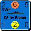
According to the CIA World Fact Book's entry on St Barthélemy: "France repurchased the island in 1878 and placed it under the administration of Guadeloupe. St. Barthelemy retained its free port status along with various Swedish appelations such as Swedish street and town names, and the three-crown symbol on the coat of arms. In 2003, the populace of the island voted to secede from Guadeloupe and in 2007, the island became a French overseas collectivity."
My least favourite rule in WiF is the intrinsic defence strength against invasion, which may be fine along the coast of Europe but is completely senseless when it comes to barely-inhabited islands in the Pacific and Caribbean. The amount of effort these places take to capture, if you are not blessed with marines, is ridiculous. That is why I am always keen to agglomerate isolated islands into larger territories with at least one port which will determine their ownership without the need to invade.
For this reason, for game-play it does make sense that St Barthélemy be part of the Gaudeloupe territory as it was historically, falling upon the capture of Basse-Terre ... and that St Eustatius be part of the Netherlands Antilles (labelled Dutch West Indies), from where it was administered historically.
I strongly approve of the way that the Cayman Islands are shown as being part of Jamaica rather than owned by the CW, and suggest we need more of this.
This is already the case for St Eustatius as part of the Dutch West Indies.
We could do the same for that hex where St Martin & St Barthelemy by making it part of Guadeloupe.
This would remove the "French Antilles" label from the map, and make this hex conquered by the conquest of Basse-Terre.
I looked in the data file, and this hex 95,325 is the only hex belonging to the "French Antilles" Territory, thus this Territory (#30 in the countries list) would disappear.
Moreover, the French Antilles refers to the four territories presently under French sovereignty in the Caribbean: the two overseas departments of Guadeloupe and Martinique, plus the two overseas collectivities of Saint Martin and Saint-Barthélemy (http://en.wikipedia.org/wiki/French_Antilles). If Saint Martin and Saint-Barthélemy were governed from Guadeloupe (which is supported by http://en.wikipedia.org/wiki/Guadeloupe), then it is true that we do not need it.
Another solution would be to delete the Martinique & Guadeloupe Territories, and make them part of the French Antilles that would contain Guadeloupe, Martinique and Saint Martin & Saint-Barthélemy, but I'm not sure that the French Antilles were ar real world entity, so maybe it is best to simply go with the first solution.
Other opinions ?
|
 Printable Version
 RE: MWiF Map Review - America -
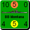


 Ah, I see. Thank you for clearing that up.
  New Messages
 No New Messages
 Hot Topic w/ New Messages
 Hot Topic w/o New Messages
 Locked w/ New Messages
 Locked w/o New Messages
 Post New Thread