WildCatNL
Posts: 513
Joined: 3/27/2009
From: Eindhoven, the Netherlands
Status: offline

|
(July 10, 2014 - last update)
I've redone _all_ 27 Red Storm maps _again_, with a whole bunch of improvements, and a web page providing samples and more detail. Download them here.
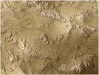
Sample of a full map (Red Storm 9 aka Hameln, used in the Pied Piper Scenario, 'Summer' theme):

Zoom-in on a map (Red Storm 1, 'Summer inverted' theme):

Available for download here are:
- summer maps (27 maps), lighter-is-higher elevation colors
- summer 'inverted' maps (27 maps), darker-is-higher elevation colors
- winter maps (27 maps)
- printer-friendly black & white .jpgs of all 27 maps, for note taking / sketching your own plans and enemy CoAs
 
Features
- 1km grid lines, to make judging distances easier (as in Flashpoint: Germany 1985)
- clear elevation differences, with contour lines, clear steps between hexes, relief shading, field and forest colors being different for each elevation level, and simple dark to light elevation color coding*: higher-is-brighter
- road names (in addition to town names), to match the briefing and to make it easier to formulate and memorize your plans
- three types of roads are drawn on the map: highways (A##), major roads (N##) and minor roads (L/K/St), with larger roads being wider. Highways have their name on blue shields, major roads on yellow shields.
- so-called "clear" terrain is drawn to feature some brushes and trees, making it more obvious that this type of terrain it is harder to move through and to see through than the "fields" terrain. (The FC:RS manual says: "[t]hese tiles are not really "clear" but they have a small amount of rolling hills, some trees, field and buildings".)
- consistent styling for all maps.
*: Except for the 'Summer inverted' theme, which features light-to-dark elevation colors, as requested by the community.
Change log:
2014 07 08: Labeled virtually all streams on all 27 maps, since these play a key role in battles and AARs. Updated printer-friendly maps with the urban 'perimeter blocks'.
2014 06 26: Render a 20 pixel margin around the map, with hex grid coordinates, for a paper map "look".
2014 06 10: Represent towns and cities as a mesh of urban 'perimeter blocks', with irregular town shapes. Reduce blurring.
2014 04 05: Changed representation of "mixed" aka "clear" terrain to tree clumps (if no road nearby) and tree lined roads (if nearby road). Added subtle large soft shading behind hills. Toned down elevation color blending of forests since hill shades made elevation more clear.
2014 03 24: Introduced 'Summer inverted' theme with darker-is-higher elevation coding. Tweaked elevation colors for Summer themes so all colors derive from green. Render trees with more highlights and shades. Draw (metric) map scale in bottom left corner.
2014-03-17: Updated to match 2.03a. Smoothened sides of rivers (not streams), hills, and roads using splines. More accurate roads.
2014-02-20: Updated to match 2.03. Fix bug in hex outline, and added some pertubation to the hex outline for a more organic, less "hexy" look. Improve map borders (notably streams running along border).
2014-02-08: Blend forests and fields with elevation base color so elevation is more prominent. Improved road network (by scanning the original .png file). Change road coloring to Google maps style orange/yellow/white. Use satellite image backdrop for fields. Smaller font size for labels, since maps are being used zoomed-in. Gray urban houses to contrast with red rural houses. Reduced number of road lables. Change file format to 8bit/channel for smaller file sizes. Smoothen/blur most of map to show fewer jaggies when zoomed-in. Printer-friendly maps added.
2013 12 31: Initial version
William
< Message edited by W1ll14m -- 7/22/2014 7:45:16 PM >
_____________________________
William
On Target Simulations LLC
|
 Printable Version








 New Messages
 No New Messages
 Hot Topic w/ New Messages
 Hot Topic w/o New Messages
 Locked w/ New Messages
 Locked w/o New Messages
 Post New Thread