WildCatNL
Posts: 513
Joined: 3/27/2009
From: Eindhoven, the Netherlands
Status: offline

|
quote:
ORIGINAL: The Plodder
William, what programs are you using to manipulate the elevation data and create the hill shading? I'd love to see what I could come up with using this stuff..
I'm using QGis (free, runs on Windows, Linux, probably OSX as well). It can load raster data in most elevation formats, it can load OpenStreetMap vector data, it can show overlay/underlays from Google/Bing/Yahoo tile based map sites, it lines all of this up based on coordinates. It allows you to edit and render the raster and vector data as you see fit.
I've been able to configure it to output maps in FCRS scale (1km per 128 pixel), render vector data in FCRS colors, render elevation data in FCRS colors (after manually defining elevation levels). I've even figured out a way to create hex overlay (for 1:50000 only), which enables me to edit and line up roads and streams better.
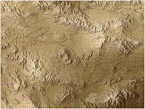
However, the tool is quite complex/rich in features and buttons. OpenStreetMap vector data typically is incomplete (missing fields and forests in Germany, missing almost everything for US military bases such as Ft. Irwin, and inconsistent between regions/countries. And the hill shades QGis generates from elevation data aren't too good looking (blurring high res elevation data prior to computing the hill shade probably helps).
And, yes, I'd love to see what you can come up with using this tool too!
If you need a (rough) walk-through how to use QGis, or need something right now for your Berlin, let me know.
William
_____________________________
William
On Target Simulations LLC
|
 Printable Version


 New Messages
 No New Messages
 Hot Topic w/ New Messages
 Hot Topic w/o New Messages
 Locked w/ New Messages
 Locked w/o New Messages
 Post New Thread