Matrix Games Forums

Forums  Register  Login  Photo Gallery  Member List  Search  Calendars  FAQ 

My Profile  Inbox  Address Book  My Subscription  My Forums  Log Out

RE: Maps for MWIF

 
View related threads: (in this forum | in all forums)

Logged in as: Guest
Users viewing this topic: none
  Printable Version
All Forums >> [New Releases from Matrix Games] >> World in Flames >> RE: Maps for MWIF Page: <<   < prev  1 [2] 3 4 5   next >   >>
Login
Message << Older Topic   Newer Topic >>
RE: Maps for MWIF - 7/8/2005 12:57:28 AM   
Greyshaft


Posts: 2252
Joined: 10/27/2003
From: Sydney, Australia
Status: offline
Everyone knows that the China war will need a detailed review for balancing purposes if we use a unified scale and part of that review will be examining how unlimited divisional breakdown affects the game. I don’t see an alternative to coding it. The option might be pulled out before the game ships but you can’t test it without coding it. Game balance might be tweaked by changing the number of divisions available to Japan but lets not start THAT religious war right now.

Map overview options aren't really a problem. There's a bunch of different techniques out there in different games and I'm sure Steve is up to the task of coding whichever one seems most appropriate - with "appropriate" being defined over time by the loyal fan base in this Forum of course

_____________________________

/Greyshaft

(in reply to c92nichj)
Post #: 31
RE: Maps for MWIF - 7/8/2005 1:08:28 AM   
Shannon V. OKeets


Posts: 22095
Joined: 5/19/2005
From: Honolulu, Hawaii
Status: offline
quote:


1) How will you give the player the ability to get an overview? This is where CWiF failed miserably, and where MWiF must succeed. In the real world, you simply stand beside the map, looking at it, and you get an instant overview. This is very important, to be able to get this overview in MWiF, because much of what makes WiF so great, is being able to hover over the map like that and ponder your moves.

2) Does this include the Americas, Africa, Scandinavia?


I sympathize with wanting to see everyting at once using 30 square feet of map. I own two butcher block tables (2.5 ft by 5 ft) with stainless steel legs and custom made 1/4 inch glass tops that let me place the maps under glass and the units on top. Drinks can then be placed on the tables without getting the maps wet. Alas, these tables sit stored in a closet for lack of room (or my wife's patience - same thing).

What a player has is probably a 17 inch monitor. [Which reminds me to start another thread on what hardware and software people expect to play MWIF on.]

CWIF splits the screen into sections for the detailed map, global map, and unit information. There is also a menu bar at the top with selectable options. I like the menu bar since it doesn't take up much room and has functionality that is likely to be used frequently during play. I intend to make all the rest of the screen available for map display. Other particulars of the interface design I want to leave for a future thread.

The CWIF system permits 8 levels of zoom. On my 19 inch flat monitor I get hexes that are roughly 3/4 inch across at 100% resolution. Zooming in makes the hexes larger and they max out at double the size (roughly 1.5 inches across). The units for the two resolutions are 1/2 inch and 1 inch respectively. Zooming out to 50% resolution cuts the hex size to 3/8 of an inch and the units to 1/4 inch. That is not too bad for getting an overview of China. I would probably play at 100% most of the time and zoom in when examining the front line in Russia hex by hex. I do not see much use for the 25% level of zoom since everything is so small then. However, Chris has already written all the code for it and it all works fine so I am planning on keeping it.

One change that I think will be appreciated by the players is that I want to change how the units appear in each hex. CWIF permits stacking an unlimited number of units in a hex (to accommodate the naval units). These stacks have only the top unit visible and it is a simple mouse click to leaf through all the units in a hex. There is also a separate panel that shows all the units in the hex beneath the cursor. This works pretty nicely but has the same drawback playing over the board has: you cannot see all the units that might launch a ground attack at once. I think the computer can do better.

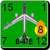
If you take the size of the units at 100% resolution (1/2 inch) and place them in a hex at 200% resolution (1.5 inch), you can place them side by side in a 2 by 2 grid. This lets you see four units per hex. Each land unit in the hex would be visible in its own cell in the little grid (maximum of 3 land units per hex) and all the planes could be stacked in the fourth cell of the grid. This means that you could see all the land units from Switzerland to the English Channel on the screen at once. No thumbing through each hex to see what's where. This could also work at the two lower resolutions though at 150% you would need a keen eye for the units would only be a 1/4 inch across.

In summary, a 17 inch screen will never properly replace 30 square feet of table. On the other hand, it can give you a better view of frontline combat.


_____________________________

Steve

Perfection is an elusive goal.

(in reply to Hortlund)
Post #: 32
RE: Maps for MWIF - 7/8/2005 1:11:49 AM   
Mziln


Posts: 1107
Joined: 2/9/2004
From: Tulsa Oklahoma
Status: offline
I favor the CWiF (A.K.A. the European scale) map scale

(in reply to c92nichj)
Post #: 33
RE: Maps for MWIF - 7/8/2005 2:54:02 PM   
Caranorn


Posts: 424
Joined: 8/31/2001
From: Luxembourg
Status: offline
Sorry for not catching up on all the previous posts, here is just my opinion on the broad questions raised here.

Scale preferably the one introudced in CWiF. Having a single scale has many advantages and the China issue (which is real as became clear in CWiF's beta tests) can be fixed by rebalancing and possibly reconsidering the use of armies in the Chinese and Japanese OOB's (that is a possible new land OOB for Asian countries).

Map graphics themselves moddable as I already mentionned in another topic. That would probably mean separating the map into two parts, hexes and features (cities, ports, factories, resources, railroads etc.). Have the map itself (hexes) be fixed, preferably a single graphic file. Have features (each using a unique ID and graphic file) added over the map by the game program. Have the large map and small feature files moddable (obviously requiring the same palette size etc.) as well as the feature position etc. moddable via a CSV file (to add/remove features from the existing map).

Now if the map cannot be modded (either entirely or no adding/removing of features) that would still work for me (though it would raise some map questions concerning resources and factories as we do have 2 or 3 distribution used so far (pre America in Flames (which added some black/red factories and resources as well as the new green ones), post America in Flames and CWiF)). But I'd greatly prefer as much moddability of the game as possible and that includes the distribution of map features and map graphics.

Marc aka Caran...

(in reply to c92nichj)
Post #: 34
RE: Maps for MWIF - 7/8/2005 3:52:20 PM   
Greyshaft


Posts: 2252
Joined: 10/27/2003
From: Sydney, Australia
Status: offline

quote:

ORIGINAL: Shannon V. OKeets
If you take the size of the units at 100% resolution (1/2 inch) and place them in a hex at 200% resolution (1.5 inch), you can place them side by side in a 2 by 2 grid. This lets you see four units per hex. Each land unit in the hex would be visible in its own cell in the little grid (maximum of 3 land units per hex) and all the planes could be stacked in the fourth cell of the grid. This means that you could see all the land units from Switzerland to the English Channel on the screen at once. No thumbing through each hex to see what's where. This could also work at the two lower resolutions though at 150% you would need a keen eye for the units would only be a 1/4 inch across.

Alternatively consider the option of Filters to only see your choice of air / ground / naval units on the map


_____________________________

/Greyshaft

(in reply to Shannon V. OKeets)
Post #: 35
RE: Maps for MWIF - 7/8/2005 5:23:30 PM   
Shannon V. OKeets


Posts: 22095
Joined: 5/19/2005
From: Honolulu, Hawaii
Status: offline

quote:

ORIGINAL: Caranorn

Sorry for not catching up on all the previous posts, here is just my opinion on the broad questions raised here.

Scale preferably the one introudced in CWiF. Having a single scale has many advantages and the China issue (which is real as became clear in CWiF's beta tests) can be fixed by rebalancing and possibly reconsidering the use of armies in the Chinese and Japanese OOB's (that is a possible new land OOB for Asian countries).

Map graphics themselves moddable as I already mentionned in another topic. That would probably mean separating the map into two parts, hexes and features (cities, ports, factories, resources, railroads etc.). Have the map itself (hexes) be fixed, preferably a single graphic file. Have features (each using a unique ID and graphic file) added over the map by the game program. Have the large map and small feature files moddable (obviously requiring the same palette size etc.) as well as the feature position etc. moddable via a CSV file (to add/remove features from the existing map).

Now if the map cannot be modded (either entirely or no adding/removing of features) that would still work for me (though it would raise some map questions concerning resources and factories as we do have 2 or 3 distribution used so far (pre America in Flames (which added some black/red factories and resources as well as the new green ones), post America in Flames and CWiF)). But I'd greatly prefer as much moddability of the game as possible and that includes the distribution of map features and map graphics.

Marc aka Caran...


What I have started working towards is one large CSV file for the 70200 hexes. It would contain the base terrain type plus information about weather zone, country boundaries, sea zone, and the river and coast hexsides. As you proposed, separate CSV files would hold info on cities, ports, resources, factories, rail lines, named hexes, other names (e.g., countries). The secondary files would all be keyed by hex column and row to link them back to the large map file. This is pretty simplistic and from my 1970's computer background horrendously wasteful of disk space - which is way out of date with the availabilty of GB hard drives that are relatively cheap.

CWIF already contains code about the green factories. Were they introduced in America in Flames?

_____________________________

Steve

Perfection is an elusive goal.

(in reply to Caranorn)
Post #: 36
RE: Maps for MWIF - 7/8/2005 5:24:27 PM   
Shannon V. OKeets


Posts: 22095
Joined: 5/19/2005
From: Honolulu, Hawaii
Status: offline

quote:

ORIGINAL: Greyshaft


Alternatively consider the option of Filters to only see your choice of air / ground / naval units on the map


Definitely.

_____________________________

Steve

Perfection is an elusive goal.

(in reply to Greyshaft)
Post #: 37
RE: Maps for MWIF - 7/8/2005 5:49:44 PM   
Froonp


Posts: 7995
Joined: 10/21/2003
From: Marseilles, France
Status: offline
quote:

CWIF already contains code about the green factories. Were they introduced in America in Flames?

Yes they were.
They are printed on the AiF maps, and the AiF maps are usable in regular WiF FE games, but you just ignore green factories.
A new WiF FE America Mpnimap was also reprinted in 2000 to show the new American factories & resources introduced in AiF, so that there is no discrpencies between games with or without the AiF maps (however, one resource was forgotten on the minimap).

Best Regards
Patrice

(in reply to Shannon V. OKeets)
Post #: 38
RE: Maps for MWIF - 7/9/2005 2:41:07 AM   
boneyman1769


Posts: 3
Joined: 7/3/2005
Status: offline
I like the idea of a unified scale and would like a map of the entire world. That way it would be easy to include America and Patton and possibly a DoD version. Although I always thought the political system in America was pretty doable as an alternative to DoD.

I find this argument of China very entertaining. I showed a group of guys I played WIF6 with in Chicago, that Japan could, on a regular basis, take most of China by the end of 1941. The idea of a stalemate in China is a myth. In fact without special rules Japan should own most, if not all, of China by the beginning of 1942. I showed these guys my techinique and last I heard, I am no longer in Chicago, they were merrily bashing others that thought China could hold off Japan.

The concept of unlimited corps breakdown to divisions is amusing. I would not mind seeing this as an option. I think it is better to limit corps breakdowns as otherwise the divisions become to powerful. I do disagree with the guy that says Japanese divisions are incorrect in the opening stages of the Japanese attacks in the Pacific. In fact many of the landings were not even division size. This has always been one of the drawbacks in the Pacific campaigns of WIF. The Japanese should have the SNLF divisions available as well as marines and infantry. This would make the Pacific campaigns more doable.

Cheers

(in reply to c92nichj)
Post #: 39
RE: Maps for MWIF - 7/9/2005 3:34:17 AM   
Shannon V. OKeets


Posts: 22095
Joined: 5/19/2005
From: Honolulu, Hawaii
Status: offline

quote:

ORIGINAL: boneyman1769

I like the idea of a unified scale and would like a map of the entire world. That way it would be easy to include America and Patton and possibly a DoD version. Although I always thought the political system in America was pretty doable as an alternative to DoD.


From your post I gather you haven't seen the CWIF beta version (which is my starting point for writing MWIF). The map is 360 hexes east to west and 195 north to south (70,200 total). The scale is consistent throughout matching the European map in WiF. Indeed, the CWIF European map is a perfect match with the one in WiF. The map wraps around from east to west but becomes an impaasable stygian blackness at the north and the south. Thus, both the artic and the antartic are not on the map, but all the other land masses are. As you get closer to the two poles, the accuracy of the scale suffers but that is mostly a cosmetic concern since it doesn't affect game play. The scales for Africa and Asia are different from those in WiF (more hexes in both).

_____________________________

Steve

Perfection is an elusive goal.

(in reply to boneyman1769)
Post #: 40
RE: Maps for MWIF - 7/11/2005 9:55:15 AM   
c92nichj


Posts: 440
Joined: 1/14/2005
Status: offline

quote:

ORIGINAL: Greyshaft


quote:

ORIGINAL: Shannon V. OKeets
If you take the size of the units at 100% resolution (1/2 inch) and place them in a hex at 200% resolution (1.5 inch), you can place them side by side in a 2 by 2 grid. This lets you see four units per hex. Each land unit in the hex would be visible in its own cell in the little grid (maximum of 3 land units per hex) and all the planes could be stacked in the fourth cell of the grid. This means that you could see all the land units from Switzerland to the English Channel on the screen at once. No thumbing through each hex to see what's where. This could also work at the two lower resolutions though at 150% you would need a keen eye for the units would only be a 1/4 inch across.

Alternatively consider the option of Filters to only see your choice of air / ground / naval units on the map


I'm not sure that having the units side by side will benefit playability, would it not get confusing which hex a unit is in?
I think that a one stack per hex with a good on-map filter would be great. So not only filter for naval/air/land but also custommamde filters like 'show me all unflipped fighters' something like the filter currently in place but on-map.

(in reply to Greyshaft)
Post #: 41
RE: Maps for MWIF - 7/11/2005 11:02:13 AM   
Shannon V. OKeets


Posts: 22095
Joined: 5/19/2005
From: Honolulu, Hawaii
Status: offline

quote:

ORIGINAL: c92nichj


quote:

ORIGINAL: Greyshaft


quote:

ORIGINAL: Shannon V. OKeets
If you take the size of the units at 100% resolution (1/2 inch) and place them in a hex at 200% resolution (1.5 inch), you can place them side by side in a 2 by 2 grid. This lets you see four units per hex. Each land unit in the hex would be visible in its own cell in the little grid (maximum of 3 land units per hex) and all the planes could be stacked in the fourth cell of the grid. This means that you could see all the land units from Switzerland to the English Channel on the screen at once. No thumbing through each hex to see what's where. This could also work at the two lower resolutions though at 150% you would need a keen eye for the units would only be a 1/4 inch across.

Alternatively consider the option of Filters to only see your choice of air / ground / naval units on the map


I'm not sure that having the units side by side will benefit playability, would it not get confusing which hex a unit is in?
I think that a one stack per hex with a good on-map filter would be great. So not only filter for naval/air/land but also custommamde filters like 'show me all unflipped fighters' something like the filter currently in place but on-map.


I want to provide both capabilities.

To visualize what the four units in a hex would look like, imagine cutting a large unit at 200% resolution twice: vertically and horizontally. You will still have the outside of the hexagon surrounding the resulting 2 by 2 grid. Also, the groups of four units in each hex will still form a hexagonal pattern on the screen.


Attachment (1)

_____________________________

Steve

Perfection is an elusive goal.

(in reply to c92nichj)
Post #: 42
Zooming in - 7/11/2005 12:54:12 PM   
Greyshaft


Posts: 2252
Joined: 10/27/2003
From: Sydney, Australia
Status: offline
I'm wondering if its worth having a seperate panel to display the contents of the selected hex. So you'd have the normal map with a limited amount of info for each hex but whenever you selected (clicked on) a hex the "hex panel" would fill up with the extra tonnes of info about the counters in that hex. Kinda like the SSG Ardennes Offensive combat screen where you got up close and personal with the hex under attack.

_____________________________

/Greyshaft

(in reply to Shannon V. OKeets)
Post #: 43
RE: Zooming in - 7/11/2005 5:35:52 PM   
Shannon V. OKeets


Posts: 22095
Joined: 5/19/2005
From: Honolulu, Hawaii
Status: offline
quote:

ORIGINAL: Greyshaft
I'm wondering if its worth having a seperate panel to display the contents of the selected hex. So you'd have the normal map with a limited amount of info for each hex but whenever you selected (clicked on) a hex the "hex panel" would fill up with the extra tonnes of info about the counters in that hex. Kinda like the SSG Ardennes Offensive combat screen where you got up close and personal with the hex under attack.

This is a topic for the game interface thread which I will start in two weeks or so. Don't lose the thought. Indeed, you might write it up off line with more specifics and post it as soon as I start the game interface thread.

I am spreading the threads out over 2 months for several reasons. One of which is that I need to spend some time coding in addition to monitorng the forum discussion.

_____________________________

Steve

Perfection is an elusive goal.

(in reply to Greyshaft)
Post #: 44
RE: Zooming in - 7/11/2005 7:24:40 PM   
c92nichj


Posts: 440
Joined: 1/14/2005
Status: offline
I think I understand what you mean, however I think that it will be difficult to get an overview of the front at that level of zoom, or you will need a bigscreen with awesome resoulution.

(in reply to Greyshaft)
Post #: 45
RE: Zooming in - 7/11/2005 7:47:09 PM   
Shannon V. OKeets


Posts: 22095
Joined: 5/19/2005
From: Honolulu, Hawaii
Status: offline

quote:

ORIGINAL: c92nichj

I think I understand what you mean, however I think that it will be difficult to get an overview of the front at that level of zoom, or you will need a bigscreen with awesome resoulution.

Oh I agree. The maximum overview with 4 units to the hex would be about from the the English Channel to Switzerland. That is way too small an area for an overivew of the situation in Russia or China. However, the lower levels of resolution would still be available (125% down to 25%). Though you would only get to see the top unit in a stack at those levels of resolution, it will let you get an overview of a larger area.

I, myself, would only use the 4 units in a hex resolution when planning the details of attacking a line - deciding which units are going to attack which hexes. Even at the higher resolutions, you would be able to choose between viewing 4 units in a hex or 1. In the latter case, we have been talking (in this forum) about using more pixels per unit so the units can be more detailed.

_____________________________

Steve

Perfection is an elusive goal.

(in reply to c92nichj)
Post #: 46
RE: Maps for MWIF - 7/12/2005 5:25:29 AM   
doctormm


Posts: 124
Joined: 5/28/2004
Status: offline
quote:

Strange thing
Off map boxes, and pacific map scales exist in WiF FE for only one reason : Space constrains, limit in the room available to lay down the maps.
It would be crazy to incorporate in a computer game things that exist only due to physical limits.
Even Harry the WiF FE creator supports this and says that if he could, he would have done WiF with a single scale map and no off map boxes.


Agree 100%, and would add the same for divisions and other counter limitations in the WiF. Unlimited breakdown can give lots of extra units, but who is going to want to keep throwing away combat factors simply to get more units?

(in reply to Froonp)
Post #: 47
RE: Maps for MWIF - 7/12/2005 10:46:13 AM   
kram


Posts: 36
Joined: 2/6/2004
Status: offline
I favour me too the CWif map and unlimited breakdown, however I think that on the defence to have two weaker units instead of a stronger one can be a big advantage, because often for the attacker the gain of a better attack rapport don't compensate the difficulty to dislodge two unit from a hex instead of one.
A question: the corp unit after breakdown can be produced again before all of its divisions are eliminated or not?
Thanks.


< Message edited by kram -- 7/12/2005 10:48:03 AM >

(in reply to doctormm)
Post #: 48
RE: Maps for MWIF - 7/12/2005 10:55:21 AM   
Froonp


Posts: 7995
Joined: 10/21/2003
From: Marseilles, France
Status: offline
quote:

A question: the corp unit after breakdown can be produced again before all of its divisions are eliminated or not?
Thanks.

Yes it can be rebuilt.

(in reply to kram)
Post #: 49
RE: Maps for MWIF - 7/12/2005 5:36:58 PM   
DaveLeLacheur


Posts: 3
Joined: 7/12/2005
Status: offline
I'll lodge my vote on maps for European scale for the entire world. Stodgily, I'd like to retain the WiF maps artistry, but from a marketing standpoint, I admit you can probably do better & help sell the game thereby. So "improved" graphics are fine too :-).

Good luck,
Dave L., wishing that the game would be released for Macintosh, sigh.

(in reply to Shannon V. OKeets)
Post #: 50
RE: Maps for MWIF - 7/12/2005 5:45:39 PM   
DaveLeLacheur


Posts: 3
Joined: 7/12/2005
Status: offline
quote:

ORIGINAL: Panzerjaeger Hortlund

Well, basically in WiF, the Chinese front becomes very static very fast, because there are alot of mountains and rivers, and (relatively) few hexes. That means that it is very easy to defend, and very hard to attack. The movement cost for the pacific/asia maps also ensure that most units can only take one step at a time, and sometimes not even that (i e they become flipped for moving a hex).

This is good, because in real life, the Chinese front was horribly static.


It was static in real life because the Japanese decided to stop attacking c. 1938. When they had motivation to do so again in 1944 (when US long range bombers started using forward bases in China), suddenly they made ground, at a time when Japanese forces were reeling all over the Pacific no less.

On the Chinese side, the Nationalists and Communists were at least as wary of each other as of the Japanese. If Japan was not attacking them, they would not recklessly expose themselves to potential loss to the other faction just to push the Japanese back a bit. Chiang, for example, knew well by 1942 that Japan was just a visitor (ie, the US would win the war) and that the Communists were his real foes. That's why he requested LL and then used those forces against Japan as little as possible.

The Chinese theater was static because neither side wanted to attack, not because terrain out-and-out forbid offensives. In WiF, the maps do inhibit offensives, but that's sheer logistics: ADG could not reasonably print Euro-scale maps of the entire world.

(in reply to Hortlund)
Post #: 51
RE: Maps for MWIF - 7/12/2005 7:16:48 PM   
tiredoftryingnames


Posts: 1919
Joined: 12/10/2001
From: Chesapeake, Virginia
Status: offline
Single scale for the whole world.

(in reply to c92nichj)
Post #: 52
RE: Maps for MWIF - 7/12/2005 8:25:02 PM   
Froonp


Posts: 7995
Joined: 10/21/2003
From: Marseilles, France
Status: offline
quote:

The Chinese theater was static because neither side wanted to attack, not because terrain out-and-out forbid offensives. In WiF, the maps do inhibit offensives, but that's sheer logistics: ADG could not reasonably print Euro-scale maps of the entire world.

So maybe MWiF would need additional rules to give the historic result ? Because as far as I could see in CWiF, the war in China was far from static !!!

I know that ADG had issued an optional rule for WiF FE with friction markers to hamper the Japanese in China, maybe this optional rule could exist in MWiF ?
Maybe there should also be an optional rule reflecting the Chinese reluctance to waste troops attacking the Japanese ?

At the risk of rambling, I'd suggest that the question be asked to the WiF FE designer who has the right level of knowledge of WiF FE and of History, and who could come up with a solution.

Best Regards

Patrice

(in reply to DaveLeLacheur)
Post #: 53
RE: Maps for MWIF - 7/12/2005 8:59:03 PM   
c92nichj


Posts: 440
Joined: 1/14/2005
Status: offline

quote:

ORIGINAL: Froonp

quote:

The Chinese theater was static because neither side wanted to attack, not because terrain out-and-out forbid offensives. In WiF, the maps do inhibit offensives, but that's sheer logistics: ADG could not reasonably print Euro-scale maps of the entire world.

So maybe MWiF would need additional rules to give the historic result ? Because as far as I could see in CWiF, the war in China was far from static !!!


I think that adding something to the defense of key hexes/cities, maybe something like the current warlords.

(in reply to Froonp)
Post #: 54
RE: Maps for MWIF - 7/16/2005 12:09:13 AM   
SamuraiProgrmmr


Posts: 353
Joined: 10/17/2004
From: Paducah, Kentucky
Status: offline
I vote for the unified scale.

I agree that it may change the dynamic of Asia, so I will propose this idea... Pick holes it it at will

It seems that there are two kinds of division breaking.... (1) the kind that came in the original rules and (2) the kind that is suggested to alleviate some of the possible problems on the asian map.

What if we had two kinds of divisions that mirrored those two kinds of division breaking?

The second kind of division would not cause the parent unit to go back to the force pool until both divisions were destroyed (or rather one parent unit per 2 divisions destroyed) and these divisions will not be allowed to stack in the same hex with other units. This will prevent abuse of the damage allocation when it is necessary to spread a corps over more than one hex.

We could even have a rule that says type 2 divisions must remain within a certain number of hexes.

I have been labeled a purist in the past and am leery of creating new rules out of thin air, but there really are two good sides to the map scale / unlimited divisions argument and it may need some thoughts.

Comments?


_____________________________

Bridge is the best wargame going .. Where else can you find a tournament every weekend?

(in reply to c92nichj)
Post #: 55
RE: Maps for MWIF - 7/16/2005 4:22:40 AM   
Shannon V. OKeets


Posts: 22095
Joined: 5/19/2005
From: Honolulu, Hawaii
Status: offline
quote:

ORIGINAL: SamuraiProgrammer
It seems that there are two kinds of division breaking.... (1) the kind that came in the original rules and (2) the kind that is suggested to alleviate some of the possible problems on the asian map.

What if we had two kinds of divisions that mirrored those two kinds of division breaking?

The second kind of division would not cause the parent unit to go back to the force pool until both divisions were destroyed (or rather one parent unit per 2 divisions destroyed) and these divisions will not be allowed to stack in the same hex with other units. This will prevent abuse of the damage allocation when it is necessary to spread a corps over more than one hex.

We could even have a rule that says type 2 divisions must remain within a certain number of hexes.


I like it, with some reservations. I could code it. It might be a little hard to explain to new players.

Let's put it on the list of possible ways to make sure the war in China doesn't become silly. There have been several suggestions made to prevent that and I believe we probably will have to play test them to see which to use. Of course, any of these changes that we put into MWIF will be options. I would also really like to keep the number of changes to an absolute minimum with as minor an effect as possible. You see, in my own way, I am a purist too.


_____________________________

Steve

Perfection is an elusive goal.

(in reply to SamuraiProgrmmr)
Post #: 56
RE: Maps for MWIF - 7/17/2005 4:40:50 AM   
Incy


Posts: 336
Joined: 10/25/2003
Status: offline
Having played many CWiF PBEM games:

-I really like unified scale and unlimited divisions
-for unlimited divisions to not cause disruptions to cor game mechanisms, however, I suggest two (house) rules:
1.Minor countries shouldn't be able to break down units, or else there are multiple exploits available
2.Some sort of corps-first loss rule should be played. I have a presonal favorite, basically that a DIV satisfies only half a loss, plus extra losses are half-losses.
If you use the two(or similar) rules above, unlimited DIV's basically become exactly what they were ment to be, an important tool to fill the low-density parts of the maps. Yes, Japan has more div's for it's supercombined, but there are also mor islands to take.

As for the china campaign, it is MUCH more fun in CWiF than in normal WiF. It's very high-mobility, knife-edge stuff. Both sides have horrible supply, and both sides can (and should) send DIV raiders behind enemy lines. Both sides are attacking and defending at the same time. The balance is still quite good, and more units do not really need to be added. One problem, however, is that the situation is not very stable, a small advantage to one side can easily magnify to a blowout victory.

I do have a few suggestions:

-China needs more cities. Chineese cities are currently so far apart that the loss of a front-line city will often lead to complete collapse, because the units holding the city's flanks will suddently be way OOS with little hope of ever reaching supply again (they will normally need 2-3 moves to come within 4 hexes of the next city). With more cities should go a reduced USE cost for taking cities.
-The setup rules are to advantageous for japan. China effectively has no internal lines, and are less mobile than Japan. Once they set up their defence, they're basically stuck in place. Japan can way to easily super-concentrate their forces against whatever weak spot there is in the chinese setup. This wasn't a huge issue in static WiFFE, but in mobile CWiF it can be disastrous. I suggest China should get some limited reaction to the japanese setup, (maybe a free pre-start land action??), perhaps coupled with a similar japanese "final adjustment")
-general balance is good, but if japan for whatever reson get's a bit on the ropes, it's also to easy for china to make japan pay. One should definately play with serious attack weakness or other similar options that would help allow japan to "hold the line" even with a reduced troop level.

btw, partisans work very nicely in CWiF, especially in china!!


(in reply to c92nichj)
Post #: 57
RE: Maps for MWIF - 7/17/2005 7:21:47 PM   
doctormm


Posts: 124
Joined: 5/28/2004
Status: offline
quote:

ORIGINAL: Incy

-China needs more cities. Chineese cities are currently so far apart that the loss of a front-line city will often lead to complete collapse, because the units holding the city's flanks will suddently be way OOS with little hope of ever reaching supply again (they will normally need 2-3 moves to come within 4 hexes of the next city). With more cities should go a reduced USE cost for taking cities.


If a major re-balancing is done of China, this could be part of it. But a simple solution might just be to increase the number of Chinese cities, and leave USE rolls alone. Major Japanese advances would thus be a bit more difficult, and come at an increase in Entry.

(in reply to Incy)
Post #: 58
RE: Maps for MWIF - 7/17/2005 8:11:27 PM   
Shannon V. OKeets


Posts: 22095
Joined: 5/19/2005
From: Honolulu, Hawaii
Status: offline
To All:

Please note that I have created a new thread for play balance in China. I have moved all the comments in this thread (Maps for MWIF) to the new one. If you have comments on play balance (especially in China) using the unified scale or changes in the division breakdown rules, please post them in the play balance thread.

Thanks for all your suggestions. We have a bunch of concerns, and ideas for addressing them. In the next few weeks I expect to distill them down to something we can try to reach a consensus on. Even then there will probably be too many rules, but we can play test them to reduce the number further. And then give the players options to choose from so they can set the play balance to what they think is best.

_____________________________

Steve

Perfection is an elusive goal.

(in reply to doctormm)
Post #: 59
RE: Maps for MWIF - 7/27/2005 9:06:29 AM   
rtamesis


Posts: 78
Joined: 7/24/2004
Status: offline
I vote for a unified scale for the entire world. I suggest that you look into Buckminster Fuller's projection map of the world (http://www.bfi.org/map.htm), which is the most accurate flat map of the world, superimpose a hexagonal grid on that, capture the geographical info for each hex in a database and then have the computer figure out which ocean hexes on the sides of the map are continuous to each other behind the scenes so that naval units can move continuously all around the globe. The nice thing about this map is that all the land masses are already accurate shown in the same scale. From the database, the computer could then just dynamically create the map shown to the user in the user interface depending upon what region of the world the user chooses to view or scroll to. The advantage of this approach will be a uniform scale no matter what part of the globe is viewed.


Attachment (1)

(in reply to Shannon V. OKeets)
Post #: 60
Page:   <<   < prev  1 [2] 3 4 5   next >   >>
All Forums >> [New Releases from Matrix Games] >> World in Flames >> RE: Maps for MWIF Page: <<   < prev  1 [2] 3 4 5   next >   >>
Jump to:


New Messages No New Messages
Hot Topic w/ New Messages Hot Topic w/o New Messages
Locked w/ New Messages Locked w/o New Messages
 Post New Thread
 Reply to Message
 Post New Poll
 Submit Vote
 Delete My Own Post
 Delete My Own Thread
 Rate Posts


Forum Software © ASPPlayground.NET Advanced Edition 2.4.5 ANSI

1.922