Froonp
Posts: 7995
Joined: 10/21/2003
From: Marseilles, France
Status: offline

|
quote:
ORIGINAL: ullern
From http://en.wikipedia.org/wiki/Earth I find that the Earth is 148,940,000 km2 land (29.2 %) and 361,132,000 km2 water (70.8 %).
Subtract 14 000 000 km2 for continent of Antarctica which isn't included in MWIF (also found on wikipedia) and I get 134,940,000 km2 land.
In MWIF:
Numbers of hexdots 44012
Hexes with all lake 81
Hexes with land 26107 of which 4993 is coastal hexes.
Assuming that coastal hexes are all sea because they are really tiny islands, and that I'm not going to include all lake hexes, then I'm counting 21114 full land hexes. 134,940,000 km2 land divided on 21114 full land hexes is 6391 km2 per hex.
Assuming the previous assumption is bullshit and coastal hexes should really be treated as full land hexes I have 26107 full land hexes (still not counting all lake hexes). Which gives me 5168 km2 per hex.
***
Using formula for hexagons (looked up in wikipedia again) I find that
If we count the coastal hexes as all sea, then an average hexagon must be 86 km across the shortest way, and 99 km across from corner to corner.
If we count the coastal hexes as all land, then an average hexagon must be 77 km across the shortest way, and 89 km across from corner to corner.

If coastal hexes contain 0% land, we are on your first hypothesis,
If coastal hexes contain 100% land we are on your second hypothesis.
These numbers look like my rough measurements (which are sometimes on the shortest hexagon distance, sometimes on the longest) are quite good.
If we assume that coastal hexes contain 50% land, that's 21,114 full land hexes + 2497 full land hexes (50% of 4,993 coastal hexes) = 23,611 full land hexes. 134,940,000 km2 land divided on 23,611 full land hexes is 5,715 km2 per hex.
If we assume that coastal hexes contain 50% land, then an average hexagon must be 81 km across the shortest way, and 94 km across from corner to corner.

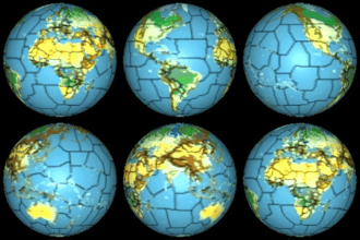
 Attachment (1) Attachment (1)
< Message edited by Froonp -- 8/14/2010 12:07:34 AM >
|
 Printable Version


 New Messages
 No New Messages
 Hot Topic w/ New Messages
 Hot Topic w/o New Messages
 Locked w/ New Messages
 Locked w/o New Messages
 Post New Thread