Philkian
Posts: 639
Joined: 1/21/2013
Status: offline

|
Maps, Units, and Player Interface
The third thing you will notice about MWIF is the maps, unit depictions, and player interface. Indeed, it is difficult to not notice the map, which is 360 hexes across and 195 hexes north to south

Only the polar icecaps are omitted from this world view. Of the 70,200 hexes, 5000+ contain hand drawn coastlines, with the scale of 136 pixels across (by 152 pixels high) representing ~90 kilometers each. Hex terrain and hexside terrain are similar to those in most wargames, but the inclusion of 250+ countries is unusual. Besides the major powers, there are aligned and neutral minor countries plus various ‘territories’ spanning the globe. As the war progresses from 1939 to the end, more and more neutral countries become aligned to one side or the other, bringing their units and resources into the war

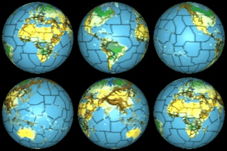
Typical for a computer war game, MWIF has both global and detailed map views. But in MWIF there are 2 levels of zoom for the global map and 8 levels of zoom for the detailed map. The zoomed out version of the global map displays the entire map within the space available on a small monitor. It can show different views of the globe: terrain, weather, hex control, combat units, and convoy pipelines. The zoomed in version of the global map takes up more screen real estate, but provides more detail. In particular, it shows individual resources (oil and non-oil), factories, and the convoy pipelines that transport resources to factories

The detailed map’s levels of zoom range from one (17 by 19 pixels per hex) up to eight (136 by 152 pixels per hex). Most of the time the game is played at zoom levels 4 to 6. But there are times when zooming out to levels 1 or 2 to gain a wider perspective on the frontlines is useful. Likewise, zooming in to level 7 or 8 can be a great help when considering tactics for attacks on a densely packed frontline

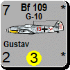
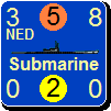
Complementing the detailed map’s zoom levels are two levels of resolution for unit depictions. High resolution shows the unit’s name and bitmapped images for air and naval units. There are 1345 unique air unit bitmaps and 834 unique naval unit bitmaps. When you are using the detailed map’s lower levels of zoom, medium resolution for the units is better. It replaces the individual bitmaps with a generic bitmap for each unit type, leaving room for a larger font for the numbers. That lets you survey a large area of the engaged forces at zoom level 3 while easily reading the combat and movement factors of individual units

MWIF also has a flyout feature which can be toggled on and off

When activated, moving the cursor over a hex brings up the flyout form, which shows up to 9 units in the underlying hex at zoom level 6. Stacking land units is possible up to 3 in a hex and stacking air units is possible up to 4 in a hex. The size of the flyout form is dynamic, so, for example, if there are 4 units in a hex, a grid 2 by 2 containing the individual units is shown. With the detailed map at zoom level 3, you can use the cursor to examine the hexes in a congested frontline, moving the cursor along the frontline to see the units in each hex at high resolution and zoom level 6 in the flyout form.
The screen layouts and map views features are unique to MWIF. The size of the game necessitated adding these tools for displaying information on the screen. To tailor the game for the monitor(s) that each player has available, the screen layout tool was created. This lets you position the main form, the detailed map, the global map, and many other forms anywhere on the screens you have available

Players who have a dual monitor system typically put the global map on their largest monitor and most of the other forms on the second monitor. What goes where is up to the player. The program can save multiple screen layouts and bring up your preferred default whenever you start a game. If you are lucky enough to have 3 monitors, you could put separate detailed maps on two of the monitors, showing, say, China on one and France on the other. MWIF enables you to have as many detailed maps as you like, which comes in handy at times when examining a convoy pipeline stretching from Australia to the United Kingdom.
Undoubtedly the Map Views List is the most valuable new tool. Simply put, it lets you save the location and settings for the detailed map with a label. For instance, the Commonwealth player might have dozens of saved map views: Great Britain, the Lowlands, Gibraltar, Egypt/Libya, Burma, Singapore, North Atlantic, Bay of Biscay, Bay of Bengal, and so on

The list of map views is different for each major power

You can create as many as you want and modify them whenever you like. Then, by simply clicking on a label in the map views list form, the detailed map displays different battlefields around the world. Of course you can still scroll the maps using all the common tools for doing that in Windows. But map views make playing the game more pleasurable. A single mouse click gets you to where you want to go, and shows you exactly the part of the map you want to see.
The printed MWIF world map can be purchased separately. It consists of 24 map segments (6 east to west by 4 north to south), each of which is 42" by 27"

The screenshots for the printed map were taken of the MWIF detailed map at zoom level 8, the maximum. On the MWIF printed map the hexagon sizes are the same as those in the WIF board game maps, which makes them large enough to hold the WIF board game counters. Hence, you can play WIF over the board using a printed version of the MWIF world map.
< Message edited by Philkian -- 10/4/2013 8:16:13 AM >
|
 Printable Version


 I will be a complete newbie, though from the tutorials printed here, it looks like you did a fantastic job of helping newbs (like me) learn the way the game works! I am hoping that using online play will be easily understood, and that there will be a way to identify an opponents experience/skill level.








 New Messages
 No New Messages
 Hot Topic w/ New Messages
 Hot Topic w/o New Messages
 Locked w/ New Messages
 Locked w/o New Messages
 Post New Thread