Froonp
Posts: 7995
Joined: 10/21/2003
From: Marseilles, France
Status: offline

|
quote:
ORIGINAL: Shannon V. OKeets
I am working today on placing the sea boxes within the sea areas. CWIF did not show any sea boxes on the map. WIF Final Edition has them but the Axis and Allies have to share them. Also WIF FE sometimes has the sea boixes at weird angles and positions.
What I believe is ideal is:
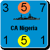
(1) For there to be two sets of 5 sea boxes for each sea area. They would be numbered from 0 to 4 and each side would have its own set. They should be arranged with one set directly above the other. The Axis units would be in one and the Allies units in the other so you can see at a glance if the enemy has units contesting a sea area - and which boxes they are in.
I'd be satisfied with only the normal 5 boxes, albeit with an enlarged size allowing to separate Axis & Allies ships & planes. Maybe with 8 places inside the box.
2 Places for the CP
2 Places for TRS, AMPH & loaded SCS
2 Places for NAV
2 Places for SCS & CVs
quote:
(2) For the sea boxes to be placed close to coasts where they are likely to be involved in land combat. For example, near invasion hexes and/or major ports where port attacks might be sent. Also near where naval air and fighter units might fly into the sea area for naval combat.
Good idea.
Even better, would be to have some number of possible positions for the sea boxes, and each player could select his prefered place. That way the sea box would be at his prefered place when it is him to be active.
Well... Not sure finally it is a so good idea... Not sure finally it is a so good idea...
quote:
(3) That they not touch the land hexes.
It is not a problem if they touch land hexes, as long as you can tell which counter is in the sea box, and which is on land. I suggest that all counters in sea boxes may have some kind of blue highlight around the counter. This way there is no ambiguity.
quote:
(4) That the sea boxes be 5 in a row with the zero box on the left and the 4 box on the right.
(5) That the name for the sea area be immediately below the sea boxes.
This is more important than it seems !
quote:
For 75+ of the 81 sea areas these objectives can all be met easily. The problem areas are the Baltic Sea, the Red Sea, the Caspian Sea, and the Persian Gulf. There might be others, I have only checked half the map so far.
The first items on the above list that can't be achieved everywhere are #4 and #3. The alternative to #4 is to place them in a diagonal running from upper left to lower right. In the Baltic, I have to split them with the zero and one boxes on the top row and the other three boxes on the next row down.
How do you feel about my list of items for the ideal? Or doesn't it matter to you? Is #1 a really good idea and items #3, #4, and #5 violated to achieve it? Wadda ya think?
One thing that would be good too, I don't remember if it was suggested elsewhere (I seem to be but can't remember), would be to have the possibility to select a number of Sea Areas, and see all their sea boxes in a kind of summary-dialog, or to print them, or another way of seeing all of them side to side. It would help overseeing CP chains & escorts and the general deployment of one's fleet at sea.
Could be good too to be able to select Ports to be shown in this view too.
Best Regards
Patrice
< Message edited by Froonp -- 9/22/2005 12:29:32 AM >
|
 Printable Version
 RE: Maps for MWIF -


 .
. 


 !!!
!!!


 New Messages
 No New Messages
 Hot Topic w/ New Messages
 Hot Topic w/o New Messages
 Locked w/ New Messages
 Locked w/o New Messages
 Post New Thread