Incy
Posts: 336
Joined: 10/25/2003
Status: offline

|
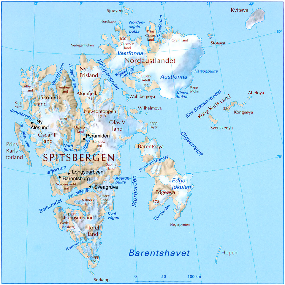
Hi, I've checked the historic names with the Svalbard museum/(ran by the Svalbard sysselmann) , and according to them the official name for the archipelago is and was Svalbard.
Also according to them, norwegian and allied forces used "Svalbard", while german forces mostly used "Spitsbergen" (I think they're wrong here, AFAIK the germans used "Spitzbergen").
They also inform me that US and UK forces used Bear Island for "Bjørnøya" (Bear Island is just a literal translation of the norwegian name).
So if local names are to be used, I think "Svalbard" and "Bjørnøya" are correct (and "Spitsbergen" + "Edgeøya" for the western and eastern islands shown)
Another island for the map should be Jan Mayen (No), which should be 1 mountain hex, located 600 km north of icland and 500 km east of Greenland.
http://en.wikipedia.org/wiki/Jan_Mayen
The main purpose if that island would of course be to make a little splotch in the middle of all that blue. The island is 55 km long and features a big volcano, and was uninhabited during WW2.
quote:
ORIGINAL: Froonp
quote:
Names for the arctic ilands should be changed.
"bear island" is english. "Bjørnøya" in norwegian.
"Spitzbergen" is german. "Svalbard" in norwegian. (The main island of the archipelagio is called spitsbergen (with S, not Z))
The Oxford Companion to WWII has it that Spitzbergen is the wartime name, and Spitsbergen is the current name.
Same for Bear Islands, WWII maps of the area have it named Bear Island (Oxford Companion to WWII p.36-37)
quote:
The map for Svarlbard is quite poor, for better map and proper names, see:
I had made another drawing of this place, but Rob drew its own before I sent him mine.
EDIT : Sorry for the double post, I thought that my first post was lost, so retyped it, shorter, a second time.
|
 Printable Version


 New Messages
 No New Messages
 Hot Topic w/ New Messages
 Hot Topic w/o New Messages
 Locked w/ New Messages
 Locked w/o New Messages
 Post New Thread