Shannon V. OKeets
Posts: 22095
Joined: 5/19/2005
From: Honolulu, Hawaii
Status: offline

|
quote:
ORIGINAL: Froonp
Steve, while doing the screenshot for page 6 of the tutorial 9, that shows oversea supply, I found that it was not easily seen in MWiF whether supply flowed or not through a sea area.
Depending on the optional rules chosen, supply flows if you have certains units at sea. CP, TRS, AMPH generaly.
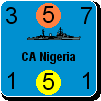
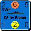
On the paper WiF FE game, those units are generaly put in a visible way in or around the sea box section in which they are, so that each player knows at a single glance if supply flows for him or his enemy throught a sea area or not.
In the MWiF game, all units in a sea box section are placed on the top of each other in one single stack of units, so if the CP / AMPH / TRS is not the top unit, you don't see it, so a player don't know at a glance if supply flows for him or his enemy through a sea area or not.
I suggest that there is some form of indicator that shows whether supply flows or not. This may be on the Global Map or the Main Map.
The Global map already shows if you have CP, how many, and also it you have TRS / AMPH and how many, so if you are used to the numbers on the Global Map, you can see supply flow.
But I'd suggest that a more evident way is used. On the Main Map, we could simply have a green light appear beside the sea area name if the Wallies supply flows, and a Red light if the Axis supply flows (or another color that reminds of the Axis side). The light would become gray (or disappear) if no supply flows. It would then be evident if supply flows or not.
Maybe this indicator would only be activated in the game if you use the Optional Rule that requires CP / TRS / AMPH at sea for supply to flow, because I seem to remember that if you are not using that rule, supply flows from the moment you have a unit at sea, so it is already evident if it flows or not.
I'll think about this. There are several possible conditions depending on optional rule the presence of supply carrying naval units, enemy naval combat units (including air), and friendly naval combat units counter-acting the presence of enemy naval combat unints. And this is ignoring whether a chain of sea areas traces back to a supply source and if any units are on the other end needing the supply.
I'll need to work out where to put the sea area's status on the detailed map. Perhaps I'll simply indicate which sea sections contain Convoys/AMPHs/Naval transports. That won't be that easy because of limited real estate around counter depictions.
_____________________________
Steve
Perfection is an elusive goal.
|
 Printable Version
 RE: Supply Tutorial - #9 -


 oh Please


 .
.


 New Messages
 No New Messages
 Hot Topic w/ New Messages
 Hot Topic w/o New Messages
 Locked w/ New Messages
 Locked w/o New Messages
 Post New Thread