Senior Drill
Posts: 199
Joined: 11/21/2007
From: Quantico
Status: offline

|
quote:
ORIGINAL: squadleader_id
Thanks for the long and detailed technical explaination, Drill.
You mean "long winded and pedantically detailed technical explanation", don't you. Can't help it, it is just the way I am. But, yer welcome.
quote:
I'm still a bit confused though...
Join the club. As the newest member, it is your turn to refill the ice bucket.
quote:
"New coding of hedgerows without raised elevation" on new CCTLD maps are the ones that needs fixing, right?
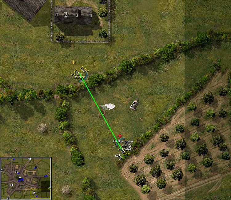
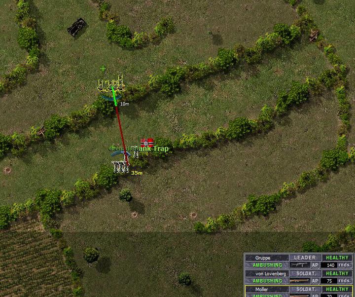
Yes. Those are the ones that are seemingly transparent to rifle and MG fire. Raised terrain elevation of the of hedgerow elements would provide an LOS block from the ajoining fields. If it is bocage country, the farthest you should be able to see from a hedgerow is the crest of the next hedgerow, with the possible execption of that exampled church steeple. It should be the terrain elevation that provides the majority of the LOS blocking, not the terrain element. In TLD one can shoot through at least one and in certain locations two hedgerows to the treeline across the second field. Only in Kansas. Not in Normandy.
quote:
I don't think there were any probs with hedgerows coding (with raised elevation) on the original CC5 maps (also GJS and BO maps).
I agree. Other than the exploding hedgerows, which was an error in the Crush To or Rubble To column of the elements file, the elevated terrain provided the LOS blocking that allowed players to mass behind large hedgerows within mere meters of enemy troops on the other side. Something that is impossible to do in TLD.
quote:
Another thing...what about the strange new CCTLD LOS glitches of firing across hedgerows that weren't present in CC5?
Addressed above. It all boils down to the lack of an elevation LOS block because the trees are set on flat, or same elevation, ground that is the same as the field elements they are next to. One could create and define 10, 20 or 30 different bocage or hedge elements with varying degress of LOS blocking or transparency: Heavy, Medium, Light, Heavy Barren, Medium Barren, Light Barren, Snow Heavy Barren, Snow Medium Barren .... ect and ad naseum, each with a varying degree of LOS cumulative blocking properties. But why bother?!!!! Simply raising the terrain element's elevation by the allowed .5 meter increments allows the map coder to a wealth of possibilities with just the few hedgerow and bocage elements:
A traversalbe slope with light cover and low probablility of immobilzation.
A traversalbe slope with light cover and high probablility of immobilzation.
A non-traversalbe slope with light cover for tall units (big tanks).
A non-traversalbe slope with heavy cover for tall units (big tanks).
A breachable section of hedgerow (a crushable to or rubble to hedgerow element) atop a .5 or 1 meter or 1.5 meter terrain elevation...
... And many, many more.
Maybe another should be added: For those that long for the pre-patch CC5 days, a mined (exploding) hedgerow element on an enticing potential breach only .5 meters tall. The tools are already in place for TLD maps to replicate CC5, BO and GJS maps, it just needs an effort by the St3 boys to make it happen.
< Message edited by Senior Drill -- 9/19/2009 1:06:03 AM >
_____________________________
C'est magnifique, mais ce n'est pas la guerre.
|
 Printable Version
 RE: Map error -
 ).
).  .
. 


 New Messages
 No New Messages
 Hot Topic w/ New Messages
 Hot Topic w/o New Messages
 Locked w/ New Messages
 Locked w/o New Messages
 Post New Thread