Matrix Games Forums

Forums  Register  Login  Photo Gallery  Member List  Search  Calendars  FAQ 

My Profile  Inbox  Address Book  My Subscription  My Forums  Log Out

RE: MWiF Map Review - Pacific Islands

 
View related threads: (in this forum | in all forums)

Logged in as: Guest
Users viewing this topic: none
  Printable Version
All Forums >> [New Releases from Matrix Games] >> World in Flames >> RE: MWiF Map Review - Pacific Islands Page: <<   < prev  4 5 [6] 7 8   next >   >>
Login
Message << Older Topic   Newer Topic >>
RE: MWiF Map Review - Pacific Islands - 8/14/2006 6:33:28 PM   
lordzyplon


Posts: 40
Joined: 7/6/2006
Status: offline
i have to say, i love what you guys did with Singapore... MUCH more realistic!

(in reply to wosung)
Post #: 151
RE: MWiF Map Review - Pacific Islands - 8/20/2006 11:32:17 PM   
Froonp


Posts: 7995
Joined: 10/21/2003
From: Marseilles, France
Status: offline
quote:

ORIGINAL: wosung
Based on the scaled map, what about adding a few more minor ports (or even just "named hexes") in Northern Papua? From West to East Madang, Buna/Dobodura and Milne Bay comes to mind. And perhaps Kavieng in New Ireland.

Well, I would be against adding ports, even minor ones.
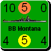
In thoses sea areas, the number of ports is also proportional to the number of air bases, I would not want to fiddle with this. We had good reasons to add some in Scandinavia (although I voted nearly against all ports addition proposals), and in China, but we can't add more only because the place is famous asa were Buna, Kavieng, Milne Bay or Biak.
About "named hexes", well I do not really know.
Named hexes are useful for islands, but are they that useful for land hexes ?
I don't care even if there are more than 1 name for each island hex, there are not many anyway, but adding "named hexes" elsewhere seems not as usefull to me.

quote:

Another thing, I noticed: On your map New Ireland basically extends from East to West. Shouldn't it extend more from North to South, that means, shouldn't the angel be steeper??

Well, it is drawn that way on the original CWiF map, and I don't see how to change this without changing all the area, which seems not usefull to me neither. It did not seem that wrong to me.

(in reply to wosung)
Post #: 152
RE: MWiF Map Review - Pacific Islands - 8/20/2006 11:33:03 PM   
Froonp


Posts: 7995
Joined: 10/21/2003
From: Marseilles, France
Status: offline
quote:

ORIGINAL: lordzyplon
i have to say, i love what you guys did with Singapore... MUCH more realistic!

Yes, and much more like WiF FE.
In CWiF it was too easy to conquer.

(in reply to lordzyplon)
Post #: 153
RE: MWiF Map Review - Pacific Islands - 9/3/2006 9:53:41 PM   
rtamesis


Posts: 78
Joined: 7/24/2004
Status: offline
While a good first effort, the Philippine Islands, especially those depicted in the Visayas region in the middle of the country, appear too skinny. I realize that there are limitations and requirements imposed by the hex grid, but I'm hoping for a more accurate depiction of the coastlines and shape of the islands in the final product since it looks odd, being from the Philippines myself. Here is a comparison of the MWIF map and the Google map to give a better idea of the shapes of the islands.


Attachment (1)

(in reply to Froonp)
Post #: 154
RE: MWiF Map Review - Pacific Islands - 9/4/2006 1:08:16 AM   
wfzimmerman


Posts: 660
Joined: 10/22/2003
Status: offline
I realize this is out of scope, but it really bothers me that Corregidor is not a fort.

_____________________________


(in reply to rtamesis)
Post #: 155
RE: MWiF Map Review - Pacific Islands - 9/4/2006 2:42:07 AM   
wfzimmerman


Posts: 660
Joined: 10/22/2003
Status: offline
quote:

ORIGINAL: wfzimmerman

I realize this is out of scope, but it really bothers me that Corregidor is not a fort, when you consider the quality of the natural fortification, the length (2 turns) of the holdout, and the courage of the occupants.


_____________________________


(in reply to wfzimmerman)
Post #: 156
RE: MWiF Map Review - Pacific Islands - 9/4/2006 11:04:45 AM   
Froonp


Posts: 7995
Joined: 10/21/2003
From: Marseilles, France
Status: offline
quote:

While a good first effort, the Philippine Islands, especially those depicted in the Visayas region in the middle of the country, appear too skinny. I realize that there are limitations and requirements imposed by the hex grid, but I'm hoping for a more accurate depiction of the coastlines and shape of the islands in the final product since it looks odd, being from the Philippines myself. Here is a comparison of the MWIF map and the Google map to give a better idea of the shapes of the islands.

The skinny aspect comes mainly from the requirements of the hexgrid. Panay, Negros, Cebu for example, must be separated by all sea hexsides, because a land unit can't go walking from one island to the next, and the hexgrid being hexagonals, the limit between 2 two-hexes island is not a straight line.
Anyway, I'll try to improve it soon.

(in reply to rtamesis)
Post #: 157
RE: MWiF Map Review - Pacific Islands - 9/4/2006 4:07:01 PM   
Froonp


Posts: 7995
Joined: 10/21/2003
From: Marseilles, France
Status: offline
quote:

ORIGINAL: Froonp

quote:

While a good first effort, the Philippine Islands, especially those depicted in the Visayas region in the middle of the country, appear too skinny. I realize that there are limitations and requirements imposed by the hex grid, but I'm hoping for a more accurate depiction of the coastlines and shape of the islands in the final product since it looks odd, being from the Philippines myself. Here is a comparison of the MWIF map and the Google map to give a better idea of the shapes of the islands.

The skinny aspect comes mainly from the requirements of the hexgrid. Panay, Negros, Cebu for example, must be separated by all sea hexsides, because a land unit can't go walking from one island to the next, and the hexgrid being hexagonals, the limit between 2 two-hexes island is not a straight line.
Anyway, I'll try to improve it soon.

Would you like it better like that ?
There is still the Leyte / Mindanao area that is not as good as reality, but to make it straight, I would have to expand Leyte and / or Samar into a third hex each. It would not be a problem to do it, but I wonder if it is worth it ?


Attachment (1)

(in reply to Froonp)
Post #: 158
RE: MWiF Map Review - Pacific Islands - 9/4/2006 8:59:36 PM   
rtamesis


Posts: 78
Joined: 7/24/2004
Status: offline
That's looking a lot better. I would not worry too much about Leyte, although Palawan still looks too short. It's not a big deal, though, if you really need to keep the existing hexes that represent it and the surrounding islands.

(in reply to Froonp)
Post #: 159
RE: MWiF Map Review - Pacific Islands - 9/4/2006 10:30:34 PM   
Froonp


Posts: 7995
Joined: 10/21/2003
From: Marseilles, France
Status: offline
quote:

ORIGINAL: rtamesis
That's looking a lot better. I would not worry too much about Leyte, although Palawan still looks too short. It's not a big deal, though, if you really need to keep the existing hexes that represent it and the surrounding islands.

rtamesis, Steve and I both think that the MWiF map will be better if it is as close as possible to the WiF FE map, and as close as possible to reality.

So I made another try at the Leyte Mindanao area, here it is. I think it is ok like this. For reality, Leyte is nearly 210 km from tip to tip, which is 3 hexes. For WiF FE, this is better too because movement is allowed by the drawing of Leyte & Mindanao, so by drawing it like this this is better.

For Palawan, nothing can be done, as an hex must be kept for the island south of it, which is part of the Philippines, and another south of it is needed for the islands that are part of Borneo.
Palawan could be extended 1 hex more, but then the island south of it won't be an island anymore in WiF FE, so I feel this is OK like this.


Attachment (1)

(in reply to rtamesis)
Post #: 160
RE: MWiF Map Review - Pacific Islands - 9/5/2006 3:01:21 AM   
Shannon V. OKeets


Posts: 22095
Joined: 5/19/2005
From: Honolulu, Hawaii
Status: offline
Patrice,

Comparing the white and blue map from rtamesis to our current version I think there is still room for improvement in places.

- The Palawan island could be make longer to extend one hex farther to the south west.

- The two islands SW of Mindo??? could be moved 1 hex to the southwest and Mindo??? could be made larger to occupy 3 hexes in a triangular shape.

- The Leyte portion looks wrong and I believe one of the straits hexsides could be removed (the southern one), making the island one large mass instead of two separate pieces. I would not be opposed to placing an all sea hex south west of Leyte - if that makes your life easier.

_____________________________

Steve

Perfection is an elusive goal.

(in reply to Froonp)
Post #: 161
RE: MWiF Map Review - Pacific Islands - 9/5/2006 6:59:30 PM   
Froonp


Posts: 7995
Joined: 10/21/2003
From: Marseilles, France
Status: offline
quote:

ORIGINAL: Shannon V. OKeets
Comparing the white and blue map from rtamesis to our current version I think there is still room for improvement in places.

- The Palawan island could be make longer to extend one hex farther to the south west.

- The two islands SW of Mindo??? could be moved 1 hex to the southwest and Mindo??? could be made larger to occupy 3 hexes in a triangular shape.

- The Leyte portion looks wrong and I believe one of the straits hexsides could be removed (the southern one), making the island one large mass instead of two separate pieces. I would not be opposed to placing an all sea hex south west of Leyte - if that makes your life easier.

I made modifications, but not always as you suggested.
- I enlarged mindoro, but not by taking a third hex southward, by taking a third hex northward.
- I enlarged Palawan, as you said.
- I also enlarged Panay by taking a third hex on the west of the island.
- About Leyte, I did not understand your suggestion, and I think it looks ok as it is here.


Attachment (1)

(in reply to Shannon V. OKeets)
Post #: 162
RE: MWiF Map Review - Pacific Islands - 9/5/2006 7:01:14 PM   
Froonp


Posts: 7995
Joined: 10/21/2003
From: Marseilles, France
Status: offline
Here is the map I took inspiration from.
I took it, as well as hundred others, from the Perry-Castañeda Library Map Collection at http://www.lib.utexas.edu/maps/.


Attachment (1)

(in reply to Froonp)
Post #: 163
RE: MWiF Map Review - Pacific Islands - 9/5/2006 7:03:05 PM   
Froonp


Posts: 7995
Joined: 10/21/2003
From: Marseilles, France
Status: offline
Looking at both maps I just posted, I think that Mindoro is too large now .

(in reply to Froonp)
Post #: 164
RE: MWiF Map Review - Pacific Islands - 9/5/2006 8:35:12 PM   
Shannon V. OKeets


Posts: 22095
Joined: 5/19/2005
From: Honolulu, Hawaii
Status: offline

quote:

ORIGINAL: Froonp

Looking at both maps I just posted, I think that Mindoro is too large now .

Perhaps, but occupying 3 hexes seems to be a reasonable choice. I can see that the numerous islands of different sizes in close proximity makes overlaying a hexgird very difficult.

I am unsure about the straits between Leyte and Samar being necessary. Both the straits above and below that one have the word 'ferry' on the map.

Thanks for the other changes.

_____________________________

Steve

Perfection is an elusive goal.

(in reply to Froonp)
Post #: 165
RE: MWiF Map Review - Pacific Islands - 9/5/2006 8:44:06 PM   
Mziln


Posts: 1107
Joined: 2/9/2004
From: Tulsa Oklahoma
Status: offline
In the Philippines between the cities of Manilla and Legaspi is a resource.

How do you trace from it to a factory for production purposes?

(in reply to Froonp)
Post #: 166
RE: MWiF Map Review - Pacific Islands - 9/5/2006 8:45:59 PM   
Froonp


Posts: 7995
Joined: 10/21/2003
From: Marseilles, France
Status: offline
quote:

ORIGINAL: Froonp
Looking at both maps I just posted, I think that Mindoro is too large now .

Here is my last try at improving the various inner islands.
What do you think ?


Attachment (1)

(in reply to Froonp)
Post #: 167
RE: MWiF Map Review - Pacific Islands - 9/5/2006 8:49:10 PM   
Peter Stauffenberg


Posts: 403
Joined: 2/24/2006
From: Oslo, Norway
Status: offline
I think the Philippines look very nice now.

(in reply to Froonp)
Post #: 168
RE: MWiF Map Review - Pacific Islands - 9/5/2006 9:03:51 PM   
trees trees


Posts: 125
Joined: 6/6/2006
From: Manistee, MI
Status: offline
quote:

ORIGINAL: Mziln

In the Philippines between the cities of Manilla and Legaspi is a resource.

How do you trace from it to a factory for production purposes?


normally WiF covers this with a special rule that any resource on a coast without a port can be picked up by a CP in the appropriate sea zone. Cyprus and Saudi Arabia are the two examples on the WiF map I believe.

But it might help to know which zone the Phillipines resource could be loaded from?

< Message edited by trees trees -- 9/5/2006 9:06:32 PM >

(in reply to Mziln)
Post #: 169
RE: MWiF Map Review - Pacific Islands - 9/5/2006 9:30:11 PM   
Shannon V. OKeets


Posts: 22095
Joined: 5/19/2005
From: Honolulu, Hawaii
Status: offline
quote:

ORIGINAL: trees trees
quote:

ORIGINAL: Mziln

In the Philippines between the cities of Manilla and Legaspi is a resource.

How do you trace from it to a factory for production purposes?


normally WiF covers this with a special rule that any resource on a coast without a port can be picked up by a CP in the appropriate sea zone. Cyprus and Saudi Arabia are the two examples on the WiF map I believe.

But it might help to know which zone the Phillipines resource could be loaded from?


Patrice has drawn this the same as in WIF FE: the resource borders both the South China Sea and the Bismarck Sea. In the final MWIF map the hex outlines will be more distinct which will help make this clearer. Also, placing the cursor over the resource will display that the hex is adjacent to both sea areas.

_____________________________

Steve

Perfection is an elusive goal.

(in reply to trees trees)
Post #: 170
RE: MWiF Map Review - Pacific Islands - 9/5/2006 9:46:12 PM   
Shannon V. OKeets


Posts: 22095
Joined: 5/19/2005
From: Honolulu, Hawaii
Status: offline

quote:

ORIGINAL: Borger Borgersen

I think the Philippines look very nice now.

Yes, I agree. But, ... Leyte is very close to Samar and using a strait as as the linkage seems like a major penalty - perhaps a river would be more appropriate?

I am a novice with Google Earth, but here's a snapshot using that tool.


Attachment (1)

_____________________________

Steve

Perfection is an elusive goal.

(in reply to Peter Stauffenberg)
Post #: 171
RE: MWiF Map Review - Pacific Islands - 9/5/2006 9:59:37 PM   
Froonp


Posts: 7995
Joined: 10/21/2003
From: Marseilles, France
Status: offline
quote:

ORIGINAL: trees trees

quote:

ORIGINAL: Mziln

In the Philippines between the cities of Manilla and Legaspi is a resource.

How do you trace from it to a factory for production purposes?

Ship only.

quote:

normally WiF covers this with a special rule that any resource on a coast without a port can be picked up by a CP in the appropriate sea zone. Cyprus and Saudi Arabia are the two examples on the WiF map I believe.

But it might help to know which zone the Phillipines resource could be loaded from?

Both.

(in reply to trees trees)
Post #: 172
RE: MWiF Map Review - Pacific Islands - 9/5/2006 10:26:47 PM   
Froonp


Posts: 7995
Joined: 10/21/2003
From: Marseilles, France
Status: offline
quote:

Yes, I agree. But, ... Leyte is very close to Samar and using a strait as as the linkage seems like a major penalty - perhaps a river would be more appropriate?

I agree they are close one to each other.
Looking at how they are depicted in WiF FE tells us more.
If we want to be as close as possible to them, moving from Davao to Manila should be possible by foot without a ship, passing straits at worst (see attached illustration).
Removing the strait between Leyte and Samar (and making them both the same land mass) would be the best way to go, because it will make the travel from Davao to Manila more WiF FE like.

quote:

I am a novice with Google Earth, but here's a snapshot using that tool.

Isn't this a great tool, and a blessing for geography loving people ?


Attachment (1)

(in reply to Shannon V. OKeets)
Post #: 173
RE: MWiF Map Review - Pacific Islands - 9/5/2006 10:33:03 PM   
Froonp


Posts: 7995
Joined: 10/21/2003
From: Marseilles, France
Status: offline
I've got another comment about the Philippines, that I have forgotten since a long time ago.
If you look at the WiF FE map (post #173), you see that the hex east of Manilla is accessible from both the Bismarck Sea and the China Sea.
In the MWiF map as it is as of today (post #1367), there is no such hex, but rather one (NE of Manilla) in the China Sea, and one (E of Manilla) in th Bismarck Sea.

Should it be changed so that the hex E of Manilla is adjacent to both Sea Areas ?

(in reply to Froonp)
Post #: 174
RE: MWiF Map Review - Pacific Islands - 9/5/2006 10:49:59 PM   
Froonp


Posts: 7995
Joined: 10/21/2003
From: Marseilles, France
Status: offline
Here is the drawing without the strait.
In this drawing, the southernmost hex of Samar extends into the hex of Leyte, so that even if the drawing show that they are 2 islands, there is no penalty for passing from one to the other in movement and combat terms.
I don't think that a River would be appropriate.
I think that it is either a Strait or nothing.
Anyway straits and rivers nearly have the same effect, excepte that there is a 1 MP penalty for Straits, and that Engineers can't negate the straits halving in combat. Straits however are treated as no penalty for marines (rivers are not), so I think that Strait was even better.

People, word your opinion here, strait or nothing ?


Attachment (1)

(in reply to Froonp)
Post #: 175
RE: MWiF Map Review - Pacific Islands - 9/5/2006 11:31:14 PM   
Shannon V. OKeets


Posts: 22095
Joined: 5/19/2005
From: Honolulu, Hawaii
Status: offline

quote:

ORIGINAL: Froonp

I've got another comment about the Philippines, that I have forgotten since a long time ago.
If you look at the WiF FE map (post #173), you see that the hex east of Manilla is accessible from both the Bismarck Sea and the China Sea.
In the MWiF map as it is as of today (post #1367), there is no such hex, but rather one (NE of Manilla) in the China Sea, and one (E of Manilla) in th Bismarck Sea.

Should it be changed so that the hex E of Manilla is adjacent to both Sea Areas ?

Yes.

_____________________________

Steve

Perfection is an elusive goal.

(in reply to Froonp)
Post #: 176
RE: MWiF Map Review - Pacific Islands - 9/6/2006 12:25:32 AM   
Froonp


Posts: 7995
Joined: 10/21/2003
From: Marseilles, France
Status: offline
Here is the result.
The Sea Area Border between the China Sea and the South China Sea has also been made as in WiF FE, with only the Manilla hex on both Sea Areas.


Attachment (1)

(in reply to Shannon V. OKeets)
Post #: 177
RE: MWiF Map Review - Pacific Islands - 9/6/2006 12:27:14 AM   
Shannon V. OKeets


Posts: 22095
Joined: 5/19/2005
From: Honolulu, Hawaii
Status: offline
Nice.

_____________________________

Steve

Perfection is an elusive goal.

(in reply to Froonp)
Post #: 178
RE: MWiF Map Review - Pacific Islands - 9/6/2006 10:13:53 PM   
sajbalk


Posts: 264
Joined: 7/11/2005
From: Davenport, Iowa
Status: offline
In WiFFE, Manila is invadable; in MWiF it does not appear to be so -- should this be changed? It does have some important game issues at stake.


_____________________________

Steve Balk
Iowa, USA

(in reply to Shannon V. OKeets)
Post #: 179
RE: MWiF Map Review - Pacific Islands - 9/6/2006 10:40:09 PM   
Froonp


Posts: 7995
Joined: 10/21/2003
From: Marseilles, France
Status: offline
quote:

ORIGINAL: sajbalk
In WiFFE, Manila is invadable; in MWiF it does not appear to be so -- should this be changed? It does have some important game issues at stake.


You're right that it is invadable in WiF FE and that it is not in MWiF.

However, the real life map seems to indicate that MWiF may have it more right than WiF FE. Manila is situated in a deep bay that is protected by the Coregidor Fort, I wonder how an invasion fleet could enter here alive.

Moreover, Manila is often directly invaded in WiF FE because there is not much better terrain around for invading (see post #173). In MWiF there are 2 clear hexes that ask for invasion, so maybe this is not a big deal if Manila is not invadable directly itself.

Manila WiF FE one hex is transformed in 6 MWiF hexes, 4 of which are invadable (and 2 are clear hexes), isn't this acceptable ?

My opinion is that it is ok as it is, it is better than WiF FE.

(in reply to sajbalk)
Post #: 180
Page:   <<   < prev  4 5 [6] 7 8   next >   >>
All Forums >> [New Releases from Matrix Games] >> World in Flames >> RE: MWiF Map Review - Pacific Islands Page: <<   < prev  4 5 [6] 7 8   next >   >>
Jump to:


New Messages No New Messages
Hot Topic w/ New Messages Hot Topic w/o New Messages
Locked w/ New Messages Locked w/o New Messages
 Post New Thread
 Reply to Message
 Post New Poll
 Submit Vote
 Delete My Own Post
 Delete My Own Thread
 Rate Posts


Forum Software © ASPPlayground.NET Advanced Edition 2.4.5 ANSI

1.203