Shannon V. OKeets
Posts: 22095
Joined: 5/19/2005
From: Honolulu, Hawaii
Status: offline

|
Well, Rob, here is a long answer.
===
II Evaluation Metric
2.1 Overview and Purpose
The AI Opponent (AIO) makes trade-offs between time, materiel, and territory. To do so it uses a common metric that can be applied to all the elements of the game described in Section I. Victory hexes are an exception. Because deciding which hex is a victory hex was somewhat arbitrary and they are scattered all over the world, it is difficult to assign each one a value in a metric that relates to the other elements of game play. So, the AIO deals with victory hexes only at the strategic level and within the Grand Strategist’s decision making.
The other game elements described in Section I are measured in terms of Combat Value (CV) or Combat Value Turn (CVT). CVs are based on the strength of land units. When multiplied by time, they become CVTs. CVs can be thought of as mass and when multiplied by time they become force. This analogy is imperfect and shouldn’t be taken as more than a convenient image. The best points of these metrics are that they let us measure: (1) the strength of each county’s force in absolute and relative terms, and (2) both the forces and time it takes to accomplish a task.
The CV system works with absolute/abstract value. A 6-4 infantry is always a 6-4 infantry. The relative value assessments based on that metric are made by the decision maker depending on the current circumstances. An air unit that is capable of flying all three bomber missions (tactical, strategic, and naval) would have one abstract CV value, but different decision makers (DMs) might assess its relative value differently (the JCS planning strategic bombing, the Admiralty planning naval combat, the Field Marshal planning ground support). At the point of making the decision, the DM calculates a mission specific CV value - the number of bombing factors the unit provides for the air mission type and the subsequent benefit in CVs of the mission succeeding. As another example, having an HQ become disorganized can be very bad. The CV value of the HQ does not change, rather the Field Marshal takes the effect of disorganization into consideration when making his decisions on attacking and defending. The FM translates the disorganization of the HQ into a CV modification due to the consequences of the HQ's changed state.
The result is a universal metric that can be applied to all decisions by the DMs. A combat risks so many CVs; sending a naval task force out costs so many CVTs; flying a strategic bombing mission risks so many CVs - with the possible benefit of inflicting so many CVs of damage on the enemy's production; an air-to-air combat has risk/reward in terms of CVs; capturing resource points gains so many CVs for our side and causes the loss of so many CVs to the enemy; and so on. To keep this metric universal, how it is calculated doesn’t take into consideration all the immediate and possibly changing circumstances. There are simply too many variables involved. At the highest level of the decision making, the metric has to be consistent.
CVs let the AIO compare the risk of taking losses versus the opportunity of inflicting losses on the enemy. This applies for land, air, and naval combats. They are the core ingredient in these decision making processes and are applied to: getting things done, land, air, and naval unit losses on the map, unit construction, and all aspects of transportation lines. They are used to evaluate combat losses and therefore for choosing where to attack. They are a crucial part of deciding which units are best to build. They measure the worth of production and the associated resource transportation lines. And finally, they enable the AIO to assign each hex a value. The last is done as an aggregation of all the previous elements and is explained in Section 2.9.
2.2 Getting Things Done
The cost of getting things done is simply the CV value of the units involved multiplied by the number of turns they will be needed/committed, including transit time. Most decisions consume resources for one turn. Land offensives are the exception to this rule. At the tactical level, Field Marshals make decisions for each impulse. They use the same basic system of units multiplied by time but substitute impulses instead of turns for the time metric. This lets them evaluate whether it is best to defer an attack until a later impulse, when the probability of its success will be better.
2.3 Land Unit Combat Values
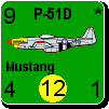
The combat value of any land unit on the map is measured in CVs. Conceptually, the CV cost of losing a unit on the map measures the unit’s combat worth. The simplest case is setting the value for a 6-4 infantry unit. It’s strength is 6 and that gives it an CV of 6. To the straight forward combat strength of a land unit, adjustments are made that take into consideration its mobility. Working from a base of 4 movements points, the combat value is incremented or decremented by a ˝ point for every difference in movement points. For example, a 7-5 infantry is worth 7.5 CVs and a 6-3 is worth 5.5 CVs. Divisional units are reduced by a full point for their lack of zones of control. There is a minimum combat value of 1 CV for a unit after adjustments, which keeps 2-1 garrison and 1-4 divisional units from becoming entirely worthless.
Many land units have unique abilities: armor, engineers, HQs, AT, AA, artillery, and divisional units in general. There are also weaker units like garrisons, territorials, and militia. The utility of their different capabilities depends on the battlefield situation. Engineers are pretty worthless on defense in the open. ATs have little value if there isn’t any enemy armor launching attacks. Armor attacking Leningrad adds nothing to the attack. Marine units inland are just weak infantry. See Section 4.2.1 for specific details.
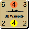
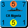
2.4 Naval Unit Combat Values
Measuring naval unit combat values is similar to how it is done for land units. Naval unit CVs (NCVs) are converted into standard CVs (i.e., land unit CVs) depending on the game situation. The range adjustments are different for naval units. See Section 4.2.2 for the details on both range adjustments and converting NCVs to CVs.
2.5 Air Unit Combat Values
For an air unit, its CVs (ACVs) depend on its primary purpose: air-to-air factor for fighters, and tactical, strategic, and naval factors for bombers. Air transport units (ATRs) are handled differently. ACVs are converted into standard CVs (i.e., land unit CVs) depending on the game situation. The range adjustments are harder to make for air units than for land units. See Section 4.2.3 for the details on both range adjustments and converting ACVs to CVs.
2.6 Production, Resources, and Factories
The AIO’s strategic plan measures the relative importance of producing armor versus infantry versus militia versus AT and so on. There may be “have to produce” quantities for infantry, armor, and HQs. Any excess production points are spent on units that have the highest CV per build point rating.
The FMs, Admiralty, and Air Marshal provide the Manufacturing Council with assessments of the value (measured in CVs) of different unit types in future years. The trade off between infantry and armor is crucial, especially for Germany and the USSR. There is also the trade off between land units and submarines for Germany. The benefit in land CVs of submarines attacking the Commonwealth merchant marine is substantial. It is measured as either the CVs the Commonwealth loses when the convoy pipeline is damaged/destroyed, or the CV cost incurred diverting build points to construct naval units to protect convoys.
During production each unit type is evaluated in terms of its combat value per build point (CV/BP). When selecting unit types for construction, one that can be built quickly may be more attractive than one that takes a long time. This depends on the effect the unit type will have arriving sooner versus later at a specific battlefield. Thus, militia and territorial units are more desirable when land units are needed immediately for defense or whose roles are simply to garrison against partisans or unlikely attacks. It also makes bombers that take 2 turns more attractive than those that take 3. There are many other factors that go into production decisions. For example, gearing limits are crucial. The AIO’s strategic plan and where it is within that strategic plan are even more important considerations.
Most naval units arrive on the map 2 years after they start production and are converted into land CV equivalents that arrive in those future turns. Indeed, the entire list of arriving reinforcements is a distribution of absolute land CVs that arrive in future turns. The AIO applies to that distribution a weighting scheme that is a function of time. The weights range from 0 to 100 percent.
Given a known or estimated stream of build points for the next X turns, they can be converted into absolute CVs that arrive in future turns. The number of absolute CVs they produce can be determined for each future turn. Build infantry and they generate CVs early. Build naval units and the CV values arrive much later. However, everything comes down to land CVs. The navy is there to transport and support the land army (and resources) and/or to prevent the same by enemy navies. The air force is only there to support the land army (plus strategic bombing) and/or to prevent the same by enemy air forces. The value of naval and air units are converted into land unit CVs. Even different types of land units are converted into standard infantry CVs (with 4 movement points). Converting other land units CVs into infantry CVs is based on their combat advantages (e.g., ENG), or the number of reorganizations they provide (e.g., HQs). It is messy, but it produces a universal metric.
At the end of the production phase, the Manufacturing Council reports the average CV value/build point for the turn. This average is based on the resulting stream of land equivalent CVs, after weighting them by time of arrival. Based on the current turn's CV distribution for future turns, the AIO projects a similar distribution for the next turn (starting one turn later) and applies the weights to that arriving CV stream. Continuing the process for remaining future years lets the AIO estimate the CV/BP for all future turns. From the CV/BP the AIO calculates the CV/resource point for the present and all future turns.
Based on the most recent production phase, the AIO calculates the value of an individual build point (BP) in terms of CVs. From that the AIO knows the value of successful strategic bombing and submarine warfare. The AIO also knows the value of a resource point (assuming it can be used in production). These may be modified if the resource points can not be used immediately because of factory constraints. Capturing factories works the same way. The value of evacuating factories is a trade off between the lost build points during the time they are out of production versus the risk of losing them completely times the number of turns remaining in the game after they are lost. Note that the value of a BP is determined separately for each major power
The main concept of this section is that each build point, resource point, and factory is worth the average CVs it can be used to produce.
2.7 Transportation Lines and Supply
Protecting convoys and controlling sea areas are first evaluated in terms of their necessity for transporting resources to factories. The cost of a convoy pipeline capacity being reduced by one convoy is measured in terms of both the convoy unit that is lost plus: the lost of the average CV/BP times the number of turns it will take to restore the convoy pipeline to full capacity. The value of rail hexes that connect a resource to a factory (e.g., in the USSR) is handled the same way. If 3 resources cannot reach a factory because the rail line is cut, then that is only slightly less expensive than having three convoys sunk. Of course, the value of each rail hex depends on it being part of a functioning rail line. This means that the CV value is associated with the rail line, and an individual rail hex is important if and only if it keeps the rail line intact. Rail lines also have additional value if they are needed to evacuate factories, maintain supply, and/or transport units by rail.
Murmansk, or any hex (e.g., a port) or sea area that is an essential part of a supply line, has the worth of the supplies that are being transported. This applies to both resources and units. The AIO also assesses the effect of being out of supply and not being able to transport units to the front.
Keeping units in supply is another function performed by transportation lines. Putting units out of supply reduces their CV directly if they are disorganized. The benefit of putting enemy units out of supply equals the changes in their CV values multiplied by how long they will be out of supply. Even organized units, when out of supply, are modified as if their mobility were zero, since moving would cause them to become disorganized. Units that are out of supply are both more vulnerable to attack and also unable to make attacks. Being out of supply at the end of a turn can at times compound the problem by denying disorganized units the ability to reorganize.
2.8 Time, Actions, and Activity Limits
There are two basic units of time in WIF: turns and impulses. Most measurements are in turns. But when the AIO moves units around on the map it’s in impulses. For example, how many impulses will it take to move a unit from its current position to another position? For naval units this is the equivalent of turns, since naval units can only move once per turn. Land and air units can relocate once per impulse and travel quite far in a single turn if that turn has 6 impulses per side. Therefore the AIO measures time in terms of impulses for moving land and air units.
For participating in combat, air units are available only once per turn. Land and naval units may be available more than that if their combats are successful or if they are on the defense and just sitting there. Air units can participate in a series of combat rounds during one subphase of an impulse but essentially they are one-and-done during a turn. This means that the number of combat impulses per turn for an air or a naval unit is one, and for a land unit, some number greater than one. The land unit’s number is based on its probability of continuing success.
From these facts the AIO measures: the maximum number of naval moves that might be wanted during a turn, the maximum number of air moves for attacks, plus rebases, and a rough estimate of the number of land moves and attacks desired. The last can be a very large number if the AIO is engaged in a major land offense. Spreading these numbers out over the likely number of impulses remaining in a turn lets the AIO evaluate its ability to accommodate the needs of the Air Marshal, the Admiralty, and the Field Marshals in terms of moves and attacks. The Joint Chiefs of Staff lets each of these decision makers know the number of moves and attacks he can expect for the rest of that turn. The decision makers then incorporate that information into their evaluations of the cost of undertaking various offenses and repositioning units under their command.
This transforms the value of time from turns and impulses into land moves, land attacks, air missions, naval moves, and rail moves! For the individual decision maker these availability numbers serve as constraints on what is feasible to accomplish in the rest of the turn. Time doesn’t really have value under this system, it is simply a constraint.
But using principles from linear programming, when a problem is viewed from a different perspective, constraints can be measured as resources. If each constraint were loosened just a bit, how much more could be done? In game terms, the Joint Chiefs of Staff asks each subordinate decision maker to report how much more he would expect to accomplish, in terms of CVs, if he were given one more land attack, one more air mission, or one more naval move.
Like all “shadow prices” these calculations of the worth of, say, a land attack, have limited applicability. Indeed, the value is calculated for the entire range of possible land attacks from 1 through N. Each additional land attack might have a different CV value. This means that the JCS develops a distribution of CV values for each of the 5 constrained activities: air missions, naval moves, rail moves, land moves, and land attacks. By knowing the value of each of the activity limits they calculate action choices. So, ultimately, the AIO calculates the value of land, naval, air, and combined actions in terms of CVs. From those numbers it gets the CV value of an impulse and turn.
2.9 Hexes
The ultimate goal is to be able to evaluate the risk of losing units in combat versus the gain of capturing hexes close to enemy capitals, resources and factories. There has to be very strong motivation in terms of CVs for the AIO, playing Germany, to drive on Paris and Moscow and to contemplate invading Britain. Victory cities only play a role in the Grand Strategist decision making.
All of this leads to the value of land hexes. Now in and of themselves, hexes usually have no value. The exceptions are the specific hexes mentioned in the paragraphs above (capitals, resources, factories, rail lines, and victory hexes) and to that list we can add sources of supply when supply is hard to come by. But even the most mundane of hexes can rise in importance when the battle lines draw near. It is as part of a front line that hexes achieve their primary importance. Looking at Germany versus France in 1940, Germany versus the USSR in 1941, and China versus Japan in any year, the outstanding characteristic of the land combat is where the front lines are. What exactly is the value of a hex in the front line?
When on defense, we can count hexes defended by rivers as worth double “the average CV for the front line” since they effectively double defensive strength. We can count forest hexes as half the enemy’s average tactical air CV since they cut ground strikes and ground support in half. We give cities a bonus for giving the defender the choice of combat tables. We penalize clear hexes if the enemy has armor capable of overrunning our weaker units and/or gaining an armor bonus. And there are similar adjustments for other types of hex and hexside terrain. But when on the attack, all of these change in importance. It is better to attack weak hexes and force the enemy to abandon strong ones because of the threat to his lines of communications.
For both attackers and defenders, maintaining a continuous line is very important. Only under unusual circumstances can the goal of maintaining a continuous line be put aside. Holes in a front line enable enemy to ooze, slip, or charge through the line, threatening the supply lines of units in the front line. Therefore, a porous front line costs CVs by means of calculating units becoming out of supply or isolated.
_____________________________
Steve
Perfection is an elusive goal.
|
 Printable Version
 RE: AI (general): location v. destruction of enemy -
  . I would be happy to assist in certain specific questions, e.g. the example of choosing the action type. checking options and choices - if everything is covered, sort of playing the bad guy: what if this, what if that etc.
  - not a good start!)


 - although these all relate to the practicalities of how decisions are made and prioritised between decision makers.


 New Messages
 No New Messages
 Hot Topic w/ New Messages
 Hot Topic w/o New Messages
 Locked w/ New Messages
 Locked w/o New Messages
 Post New Thread